|
search place name
|
||
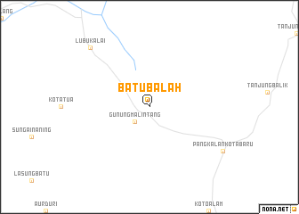
Batubalah (Indonesia)Batubalah is a town in Indonesia. An overview map of the region around Batubalah is displayed below.
regional and 3d topo map of Batubalah, Indonesia ::
Batubalah airports ::
The nearest airport is PKU - Pekanbaru Sultan Syarif Kasim Ii, located 97.3 km east of Batubalah.
Other airports nearby include PDG - Padang Tabing (115.8 km south), DUM - Dumai Pinang Kampai (185.9 km north east), RGT - Rengat Japura (196.9 km east), Nearby towns ::
Gunungmalintang (2.6km south west) //
Lubukalai (10.5km north west) //
[all distances 'as the bird flies' and approximate]  Places with similar names to Batubalah, Indonesia ::
// Buadi-Abalo (PH)
// Bad Boll (DE)
// Batıbeyli (TR)
// Batié Blé (BF)
// Batibla (CF)
// Baida Baila (TD)
// Bitobolo (CD)
// Batubala (TP)
// Bodobil (IN)
// Budabal (IN)
Disclaimer :: Information on this page comes without warranty of any kind |
||
|
Where is Batubalah? Elevation and coordinates ::
Latitude (lat): 0°8'0"S Longitude (lon): 100°38'0"E
Elevation (approx.): 180m (map arrows pan, magnifying glasses zoom) |
||
|
Visiting Batubalah? Hotel/Accommodation ::
Book a hotel in Batubalah Travel Guide ::
Buy a travel guide for Indonesia rental cars ::
car rental offers GPS waypoint ::
download a GPX waypoint (PoI) of Batubalah for your GPS receiver
|
||