|
search place name
|
||
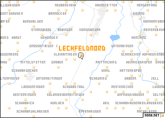
Lechfeld Nord (Bayern, Germany)Lechfeld Nord is a town in the Bayern region of Germany. An overview map of the region around Lechfeld Nord is displayed below.
regional and 3d topo map of Lechfeld Nord, Germany ::
Lechfeld Nord airports ::
The nearest airport is AGB - Augsburg, located 23.7 km north of Lechfeld Nord.
Other airports nearby include FEL - Fuerstenfeldbruck Furstenfeldbruck (29.8 km east), OBF - Oberpfaffenhofen (34.4 km south east), MUC - Munich Munchen (69.9 km east), INN - Innsbruck (112.2 km south), Nearby towns ::
Gutshof Lechfeld (1.2km west) //
Oberottmarshausen (2.2km north west) //
Kleinaitingen (2.5km west) //
Königsbrunn (5.7km north) //
Graben (4.1km south west) //
Lager Lechfeld (5.7km south) //
Prittriching (4.1km south east) //
Scheuring (6.1km south east) //
Klosterlechfeld (6.1km south west) //
Winkl (5.2km south east) //
Bobingen (6.1km north west) //
Lichtenberg (7.5km south) //
Schwabstadl (7.5km south) //
Wehringen (6.2km north west) //
Neuses (6.2km north west) //
Untermeitingen (7.4km south west) //
Beuerbach (8.3km south east) //
Adelshausen (8.9km south east) //
Obermeitingen (8.9km south west) //
[all distances 'as the bird flies' and approximate] 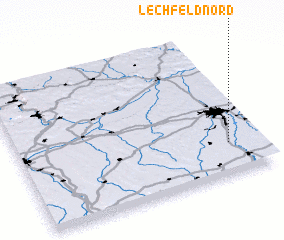 Places with similar names to Lechfeld Nord, Germany :: Disclaimer :: Information on this page comes without warranty of any kind |
||
|
Where is Lechfeld Nord? Elevation and coordinates ::
Latitude (lat): 48°13'0"N Longitude (lon): 10°52'0"E
Elevation (approx.): 538m (map arrows pan, magnifying glasses zoom) |
||
|
Visiting Lechfeld Nord? Hotel/Accommodation ::
Book a hotel in Lechfeld Nord Travel Guide ::
Buy a travel guide for Germany rental cars ::
car rental offers GPS waypoint ::
download a GPX waypoint (PoI) of Lechfeld Nord for your GPS receiver
|
||