|
search place name
|
||
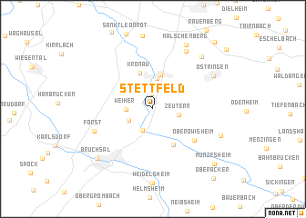
Stettfeld (Baden-Württemberg, Germany)Stettfeld is a town in the Baden-Württemberg region of Germany. An overview map of the region around Stettfeld is displayed below.
regional and 3d topo map of Stettfeld, Germany ::
Stettfeld airports ::
The nearest airport is ZQC - Speyer, located 19.4 km north west of Stettfeld.
Other airports nearby include MHG - Mannheim City (33.6 km north), ZCC - Baden-baden Baden Oos (55.0 km south west), STR - Stuttgart (69.2 km south east), RMS - Ramstein Ab (81.1 km west), Nearby towns ::
Langenbrücken (1.9km north) //
Ubstadt (2.8km south) //
Zeutern (2.2km east) //
Ubstadt-Weiher (2.4km south west) //
Weiher (2.2km west) //
Kislau (3.7km north) //
Mingolsheim (4.2km north) //
Kronau (4.5km north) //
Unteröwisheim (4.7km south) //
Oberöwisheim (5.1km south east) //
Forst (5.5km south west) //
Malsch (7.6km north) //
Östringen (6.3km north east) //
Rettigheim (7.6km north east) //
Neuenbürg (6.3km south east) //
Malschenberg (8.3km north) //
Bruchsal (7.6km south west) //
Münzesheim (8.4km south east) //
Rotenberg (9.6km north east) //
Oberacker (9.8km south east) //
[all distances 'as the bird flies' and approximate] 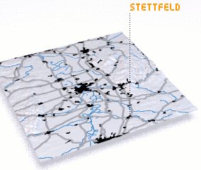 Places with similar names to Stettfeld, Germany ::
Disclaimer :: Information on this page comes without warranty of any kind |
||
|
Where is Stettfeld? Elevation and coordinates ::
Latitude (lat): 49°10'59"N Longitude (lon): 8°38'45"E
Elevation (approx.): 120m (map arrows pan, magnifying glasses zoom) |
||
|
Visiting Stettfeld? Hotel/Accommodation ::
Book a hotel in Stettfeld Travel Guide ::
Buy a travel guide for Germany rental cars ::
car rental offers GPS waypoint ::
download a GPX waypoint (PoI) of Stettfeld for your GPS receiver
|
||